Steve & Georgia Carter

Our Notebook

Page 2 of 20

Riverfront Trail Access Imperiled

On December 28, John Hodge and I attended a meeting with Pete Firmin, who is the Manager of the James M. Robb state parks, which include Corn Lake, Connected Lakes and the Fruita section. John has posted on Facebook his impressions of the meeting; I’m putting it in my personal blog because it’s really too long to fit in the standard Facebook message format. You may feel free to add comments to the end of this message, or on the Bicycle Alliance Facebook page. You can also look at the rest of this personal blog if you care to…

Our meeting was cordial; I’ve known Firmin for years when we both worked in Rifle, and he’s a good guy. However, he seemed primed for this meeting with talking points from higher up, and I learned more from what he didn’t say than what he did. The following comments are my own opinion on this situation, and don’t represent the position of the Bicycle Alliance.

Continue reading

Katy Trail


KatyTrail

Shortcuts:

Introduction

The period between 1870 and 1890 had much in common with the Dotcom bubble one hundred years later, only instead of computers, the investment of choice was railroads.  Railroads sprang up all over, but nowhere more enthusiastically than the midwest.  Many started in major cities like Chicago, St. Louis or Milwaukee, but others extended their lines from smaller towns, such as the Atchison & Topeka (later Atchison, Topeka & Santa Fe, now BNSF).  A group of investors in Junction City, Kansas thought it would be a good idea to build a railroad to ship their grain crops  to Kansas City and Texas (hence the acronym, K-T);  xmissouri-kansas-texas-railroad-map.jpg.pagespeed.ic.4VMUNNDTdI
so they promoted a railroad to Parsons, Kansas, then when they were temporarily thwarted at the Oklahoma border because nobody had thought to gain the permission of the Native Americans who owned the land,   directed their construction crews towards St. Louis and Kansas City.  After a pause at Boonville, more bonds were sold, a massive bridge was constructed across the Missouri, and track crews raced to St. Louis. And the Missouri-Kansas-Texas lines were formed. The route from Boonville to Matchens, the eastern end of the line, follows the Missouri River bottom.  That’s great for railroading, since it’s astonishingly flat,  and has few, gentle curves.  But it’s also susceptible to catastrophic floods.  Floods wiped out swaths of the railroad several times during the Katy’s 100 years of operation. 

P1030836
The Missouri portion of the M-K-T railroad never was an  overwhelming success, despite the optimistic spin from their PR department (click on the ad to the left to read it), since the line paralleled the older Missouri Pacific, and stopped near St. Louis and near Kansas City, bypassed Jefferson City, and depended to a large extent on seasonal grain shipments for income.  And periodic floods wiped out large swaths of the railroad. It went through several reorganizations and bankruptcies. When the railroad was purchased by the Missouri Pacific and then Union Pacific, the Missouri MKT line was doomed, and most of the tracks were abandoned.  The last trains ran in 1986.

A generous donation (like $2.2M generous) from the son of the founder of the Edward Jones investment company purchased the right of way; in 1991, the Union Pacific donated 33 miles of right of way between Sedalia and Clinton.  The first part of the trail was  was opened in 1990, and the entire 240 miles has become a state park. 

Meanwhile, the Rock Island railroad, which also served Kansas City and St. Louis, was abandoned and a portion acquired by Missouri State Parks. The 47.5 mile segment from Pleasant Hill, about 25 miles from Kansas City, to Windsor was completed last year.

From the Missouri State Parks map:

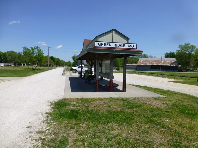
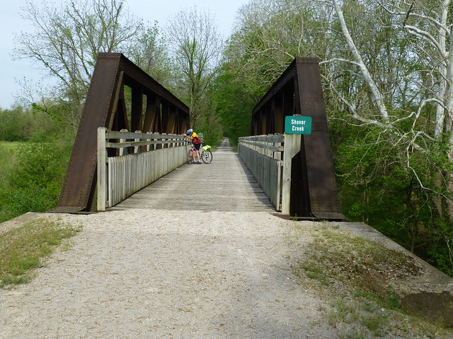
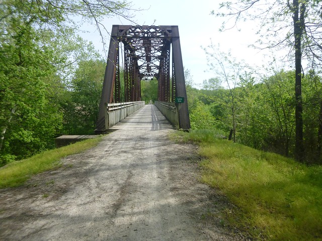
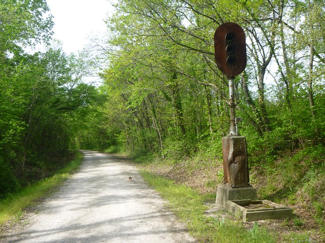
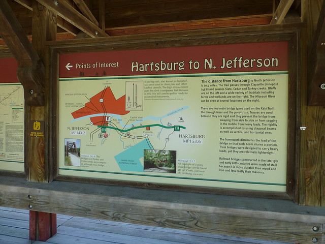
“Trail users are reminded of the trail’s railroad history as they catch glimpses of old telegraph poles and other remnant pieces of the railroad’s past.  The trail passes over numerous truss bridges on its route.  Four fully restored historic depots evoke the bygone grandeur of passenger service on the MKT, while the stone railroad tunnel at Rocheport recalls the ingenuity required to complete the MKT rail line.

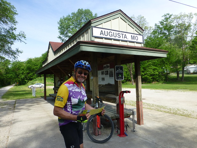
“Katy Trail State Park also takes users through a slice of rural history as it meanders through the small towns that once thrived along the railroad corridor.  These communities make great places to stop and explore during a visit to the trail, since the majority are located adjacent to designated trailheads. 

20180508T111807The majority of the Katy Trail closely follows the route of the Missouri River so trail users often find themselves with the river on one side and towering bluffs on the other.  The trail travels through many types of landscapes including dense forests, wetlands, deep valleys, remnant prairies, open pastureland and gently rolling farm fields.  In the spring, the trail is brightened with flowering dogwood and redubd, while the fall is colored with the rich reds and oranges of sugar maple, sumac and bittersweet.


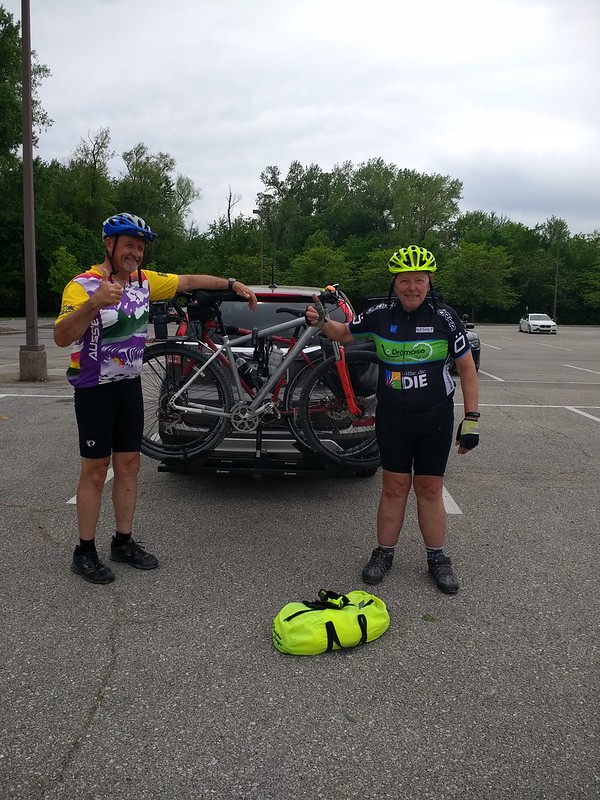
Now, please join Georgia, Gene, Maggie and me on this adventure.

Notes:  Scroll down for each day’s diary.  If you want to see any photo in more detail, just click on it. All of the Strava links will lead you to more detail, including maps. Please feel free to leave comments.

[stextbox id=”download”] Occasionally you’ll find highlighted text boxes (like this one).  Each contains music appropriate for what you’re reading.  If you want to listen to the music, just click on the audio player. [/stextbox]

Katy Trail – Day 1, Chilhowee to Sedalia

Relive ‘Katy Trail Day 1’

Our first day on the Katy Trail started in tiny Chilhowee,Missouri.

We took the Rock Island Spur, a new addition to the state park system, which was dedicated in 2016.  It follows the route of the old Chicago, Rock Island and Pacific railroad.

[stextbox id=”download”]The Rock Island Line is a Mighty Fine Road, by the famous 1930’s folk singer, Leadbelly

[/stextbox]

We’d spent the night before in a rustic  AirBnB located about 40 miles closer to Kansas City.  If we’d started from the AirBnB, our first day’s trip would have been over 100 miles.  So our support crew, Georgia and Maggie drove us to the trailhead of the recently constructed Rock Island Spur.  Twenty miles from Chihowee, it joins the Katy Trail in the town of Windsor.

View Post

P1030798

The trail is in excellent shape; the surface is smooth crushed gravel.  If it’s dry, you could do it easily with a 28mm tire; I was using a 35mm, and Gene a mountain bike tire.  Not so much after a rain, however.

Road crossings are well marked.

P1030801
P1030799
P1030803

We passed no one on the way to Windsor, and there was very little traffic on the roads.

20180507T083129
20180507T083157

As we approached Windsor, we passed under what was obviously the Katy Trail.

20180507T101318

It was approaching noon, and until we went around a corner on Main Street, we hadn’t seen any hint of a place to eat. Then we saw a familiar sign:

P1030804

Fortified with comfort  food, we retraced our route to the bridge, and followed well-marked path that lead to the Katy Trail.

20180507T101455

The Katy trail goes through a couple of small towns on the way to Sedalia, and climbs from 550 to 910 feet.  It’s almost imperceptible.

P1030806
P1030808

Most of the trail is covered by an arch of trees, which have grown up on the right of way since the railroad was abandoned.  It’s often like riding through a tunnel.  However, several miles were restored to its original condition – prairie grass – by burning the trees.  I imagine this will be a hot and miserable stretch during the summer, but in early May it was quite beautiful.

20180507T114814

The State of Missouri has constructed trailheads at most of the small towns along the way, and texting pictures of them was a good way to let Georgia and Maggie know where we were.  Each of the trailhead shelters, which were 8 to 13 miles apart,  had at least a toilet and shade, most had water, and all had interpretive signs letting you know the history of the town, what to look for going east and west, a directory of local restaurants, shops and bed & breakfast accommodations, and a history of the area and of the Katy railroad.   We took lots of pictures of the signs and shelters.

P1030809
P1030810
P1030812
P1030811

We finally pulled into the Sedalia train station about 3 o’clock.  Gene had a slow leak in a tire, and there was a good bike shop in the depot, along with a gift shop and museum.  He bought a new tire, and I bought a “Katy Komet” jersey.  A couple from Illinois cycled by with a 12 pack of beer and offered everyone a cold one.  They had started five days earlier in St. Charles, and were going to spend the night in Sedalia before catching the morning estbound Amtrak.

20180507T154205

Sedalia is a nice town of about 22,000 people which became important as a junction between the Katy and Missouri Pacific railroads; it’s the site of the Missouri State Fair, and ragtime composer Scott Joplin lived here for several years.  We stayed at the beautifully restored 1920’s  Hotel Bothwell,

Hotel Bothwell

which is actively appealing to  a niche catering  to bicyclists.  They’ll check your bike and take it in a freight elevator to a basement storage room.  I was quite surprised the next morning to find at least a dozen bikes parked in the lobby for pickup, and even more so when the room clerk told me that they had been sold out over the weekend with bicycle tours.  The economic impact to the local economies of the Katy Trail is unmistakable.

Georgia and Maggie had taken a detour to visit the extensive quilt shops at Hamilton, Missouri, but they arrived at the hotel at the same time we did.

A downtown mural shows the hotel, the courthouse, and some of the (not so) famous stars who grew up here.

20180507T194259

Katy Trail, Day 2 – Sedalia to Columbia

Relive ‘Katy Trail Day 2’

Sedalia was the home of ragtime composer Scott Joplin, there’s a festival celebrating his music every summer.
[stextbox id=”download”]Scott Joplin’s Maple Leaf Rag, composed when he lived in Sedalia

[/stextbox]
 

Sixty miles from Sedalia to Boonville to not far from Columbia.  Lots of scenery, bridges and animals.  I knew about railroads, and Gene knew about the flowers, trees, insects, small animals, fish and snakes along the road.  He also had read a book about the Lewis & Clark expedition in the early 1800’s, whose route followed the Missouri river.  And what we didn’t know, we learned from the informative signs on each of the trailheads.

P1030813
P1030814
P1030816
P1030818
20180508T080803
20180508T085351

Except for the bridges and an occasional telegraph pole, most of the remnants of the MKT railroad have been removed.  However, there were a couple of block signals still in place.  The last time this signal flashed “high green” was thirty years ago.

20180508T090420

The infrastructure on this rail trail is remarkable, uniform and understandable.  Before every town, there’s a sign that tells you its name and the services available.

P1030819

You’ll see lots of pictures of the shelters along the way.  There’s one every few miles, and each has a clean toilet facility and shade, most have water, and all have interpretive signs. A few even have bike repair stations.

20180509T111348

And the trail went on and on.

20180508T111816

Our lunch stop was a small cafe in Boonville.  This is where we met the Missouri River.  which had a museum with replicas of the Lewis and Clark expedition boats.

20180508T120845
20180508T121123

Then we realized that I had made a planning mistake.  The plan was to ride to the nearest town to Columbia, home of the University of Missouri.  It’s a big city and we ended up staying near an interstate surrounded by chain restaurants and hotels.  We should have stopped in Rocheport, after the only tunnel on the route.

20180508T144531

Rocheport is a wonderful community that has prospered because of the trail.  You’ll find  several bed and breakfasts, restaurants and other cool places to stay and visit.   

Les Bourgeois

It would have evened out the mileage, and was a real missed opportunity. 

Katy Trail – Day 3, Columbia to Jefferson City

26.8 miles

[stextbox id=”download”]The Missouri Waltz

This was the day that would have been slightly longer had we stopped in Rocheport.  Instead, Georgia and Maggie

20180510T115258

took us back to the trailhead at McBaine and we rode on to North Jefferson.  It was a short and uneventful day.

We stopped at Hartsburg, the only trailhead between McBaine and North Jefferson.

P1030820
P1030822

The only other thing I though worth a picture were a couple of turtles and an old bridge.

P1030827
20180509T130924

Jefferson City is the capitol of the state, and we stayed in a newly converted AirBnB.  Unless you are from the state, or there’s something interesting going on at the capitol building (like the impeachment of the governor, for instance), there’s no reason to stop here.

Katy Trail – Day 4, Jefferson City to Hermann to Treloar

Relive ‘Katy Trail, Day 4’

[stextbox id=”download”] The music comes later on![/stextbox]

The fourth day was much more interesting than the third. Our first stop after Jefferson City was Tebbetts, site of a popular hostel offering beds for $6 per night. Later, we met a group of elderly ladies who had spent the night there and had a wonderful time.

P1030828
Turner Katy Trail Shelter

Jesse James supposedly lived here for several years. Enlarge this picture and read about “the singing outlaw.” When you see a picture like this, just click on it and you’ll be taken to the original on Flickr; you can click on the picture there to enlarge it.

P1030829

As we continued towards Mokane and Portland, we crossed several “creeks,” many of which could carry more water than a river in Colorado.  Note the sign to the right of the bridge:

P1030832

Looked  pretty ominous, so I stopped to take a picture

P1030833

Eek!  A nuclear power plant?  In this bucolic wilderness?  Apparently so.  But if the sirens went off, indicating that there was a radiation leak, we’d be cooked, since our bikes didn’t have radios to listen to the emergency broadcasts, and we certainly couldn’t leave the area quickly enough.

Mokane and Portland, Missouri, certainly benefit from the employment, and the tax generated by the power plant. Their schools are among the best funded in the state. The trailhead was particularly nice.

The state parks department erected railroad-like mileage signs, which followed the original markings from St. Louis.  The actual trail ends north of St. Louis at Mile 26.9; we joined the trail at Windsor, 247.7  Mokane is 125.0. However, the last stretch from St. Charles (just north of the St. Louis airport) to Machens is apparently in poor condition with nothing to see, so we elected to stop in St. Charles, Milepost 40.

20180510T084607

A few miles on, we passed a landmark Standing Rock, which marks the periodic floods that devastated the area and the railroad, and was the cause of the closure of the railroad in 1986.  This spot is nearly a mile from the river; it’s hard to believe that floods could have been this deadly.

P1030838
20180510T102914

We then passed through Portland, Missouri and around the town of Rhineland.  The latter is one of only two spots on the whole trail where it appears that someone snatched the right of way before it was purchased, so you have to go around town, behind a rodeo ground, then get back on the trail on a very busy road.  No reason to stop here.

But then there’s Hermann, which is across the river from McKittrick.

[stextbox id=”download”]Cue the music.  This is the Beer Barrel Polka. Read on and you’ll discover why this selection, from the Varsity Polka Band, is so appropriate.

[/stextbox]

20180510T115323

Georgia and Maggie were waiting for us, and took us the the AirBnB we had rented in the lovely, quaint town with a rich German heritage.  I found a great AirBnB in Hermann, and we stopped there for a minute before lunch:

20180511T055011
20180511T054738
20180511T054756
20180511T054805
20180511T054811

There are many choices for German food and curios, and we picked a brewpub in an old flour mill near the Amtrak station.  The beer was cold and frosty, and the bratwurst was delicious.  Since we arrived there about 2 in the afternoon, it wasn’t crowded.

20180510T133304

Then we decided to put on an additional 20 miles by riding to Treolar, so that the last day would be shorter.  Our friendly support staff took us back to the McKittrick and agreed to meet us at Treolar in a couple of hours.  I’ve never been so glad to see them as I was when they came to pick us up at Treolar.  It was hot.  It was dusty.  The beers and the bratwurst were leaden.  Really not the best idea. 

« Older posts Newer posts »

Bad Behavior has blocked 5 access attempts in the last 7 days.