Steve & Georgia Carter

Our Notebook

Page 5 of 20

High Trestle Trail, Ankeny, Iowa

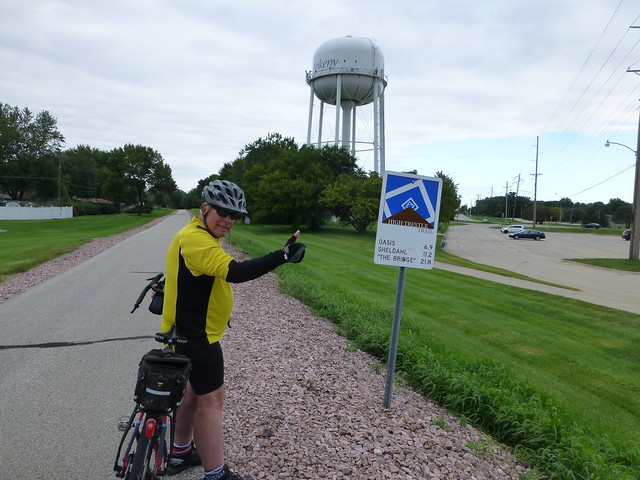
Built in the last few years on the roadbeds of two abandoned railroads, the High Trestle Trail runs from Ankeny, Iowa to Woodward.  No wind, mild overcast day, and flat.  Very flat.  And straight.  The map is deceiving; the incline and descent were almost imperceptible

I joined a friend from Cedar Rapids.  Over twenty years ago we had participated in a bike tour down the Wisconsin river; he took his son, I took Jackie.  we’d kept in touch.  Thanks, Facebook…

P1030200
P1030199
P1030203


The trail itself is asphalt and concrete, plenty wide and did I say flat?  For several miles, it proceeds northwest from Ankeny through miles of green trees and along rich farmlands.  The forest has reclaimed the area between the plowed fields and the railroad, and creates an effect like riding through a tunnel.  However, the birds and occasional views of sky and little creeks and the birds and squirrels tell you otherwise.
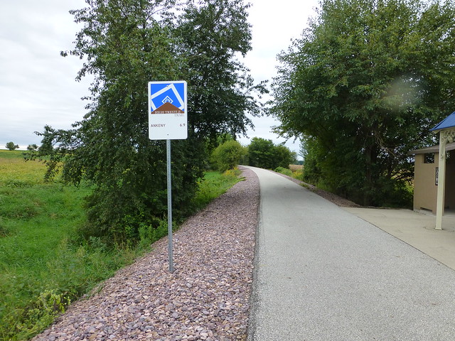
P1030205

There’s even a strategically placed potty stop.  And signs in each of the towns welcome you to fill your water bottle, enjoy their parks…

P1030223

The Milwaukee Road mainline crossed the Des Moines River on a very high trestle   built in 1912.  When the government created Saylorville Lake in 1971, the trestle had to be rebuilt, this time using concrete pillars.  The railroad lasted only another thirty years; when the Union Pacific tore down the bridge, they donated the pillars for the construction of a bike path.  It’s really quite spectacular:

P1030209

Colored LED lights illuminate the metal decorative boxes which enclose the bridge, and at night apparently creates a really spectacular light show.
P1030217

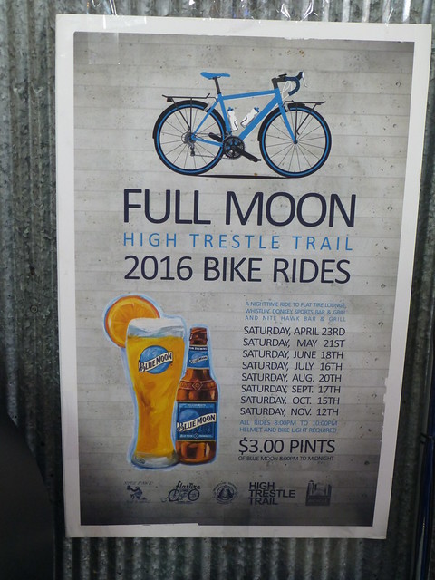
We joined Sharon and Georgia for pizza at the trailside bike-themed Flat Tire Lounge.
P1030233
P1030236

For more pictures, click on the thumbnail:
[RFG_gallery id=’16’]
Wrong turn!

What We Learned Today:  Allen and I learned that the gas plant can’t be reached from 20 Road.

[sgpx gpx=”/wp-content/uploads/gpx/Wrong_turn.gpx”]

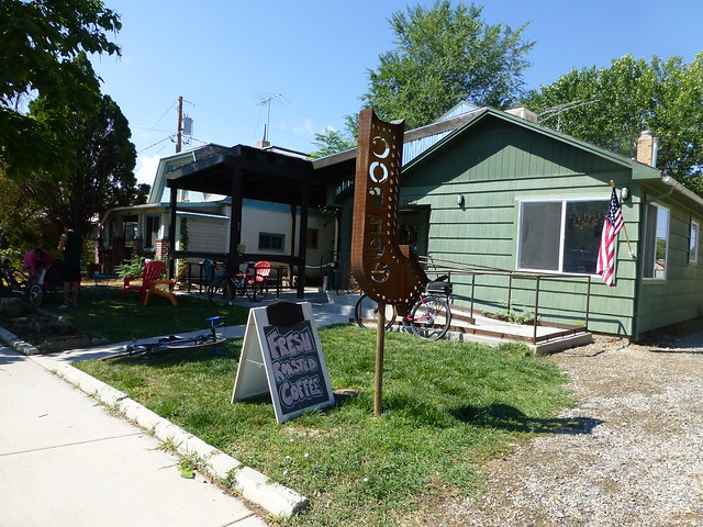
The weather yesterday was delightful – a tailwind to Fruita and calm winds thereafter.  Temperature in the mid 80’s.  Few clouds.  As has become our custom, we stopped at the Bestslope Coffee Company at 129 N. Peach Street.

Fruita Coffee House

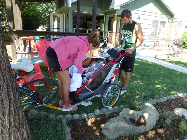
It’s run by a former middle school science teacher and was backed by the Hot Tomato ladies.  The coffee is good, particularly their cold brew, and the company pleasant.  We ran across the parents of 8 week old twin boys, who had taken them out for a ride while Mom & Dad  enjoyed coffee:

Twins

I think the mom is the sister of the owner, and SHE was the one who was hauling the trailer with the little boys.


Fort Laramie

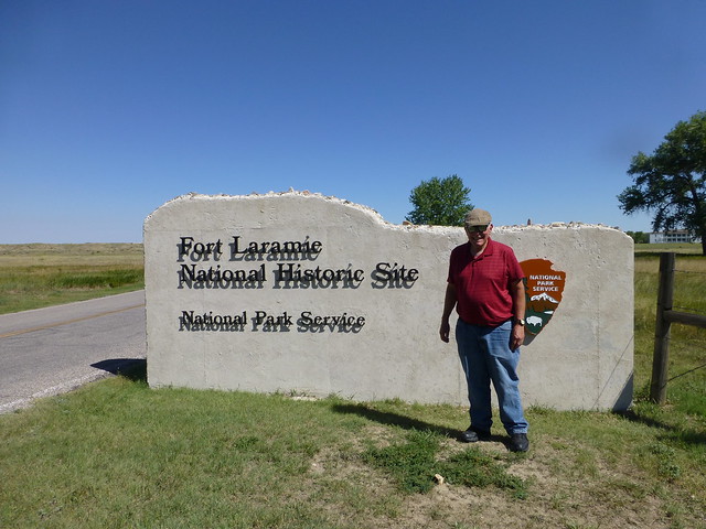
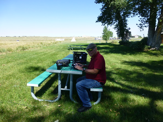
If any ham radio operators read this, are interested in the NPOTA contest and are looking for a great place to activate, I can recommend the Fort Laramie National Historic Site, NS-20.

Ft. Laramie Entrance

It’s located about 2 hours north of Cheyenne, is in a beautiful location, is quite interesting with several restored buildings, has some very helpful rangers and reenactors. And if they aren’t occupied, you can operate out of a tepee. There has been a fort there since 1834, and according to the rangers, every pioneer who traveled west stopped there, so if you set up in the shaded picnic area (or in the tepee) you’re bound to be on the spot where hundreds of covered wagons passed 150 years ago. There aren’t any places to camp on the site, and the nearest motel is about 25 miles away, but it would be worth spending an entire day there. With four trails + a National Historic Site + Wyoming, anyone who sets up there is sure to make lots of contacts, and every one of them will be happy when the log is uploaded.  I only had a brief time yesterday to activate the site, and only got 18 contacts on 20M CW, and wish I could have stayed several hours longer.

Ft. Laramie NHS

The best part is that admission is free!

Cheyenne

Cheyenne has a surprising variety of bike paths, although like Grand Junction, they’re poorly marked.  But if you have a guide, you can see a lot of this interesting city.

[sgpx gpx=”/wp-content/uploads/gpx/AUG-22-16 033355 PM.gpx”]

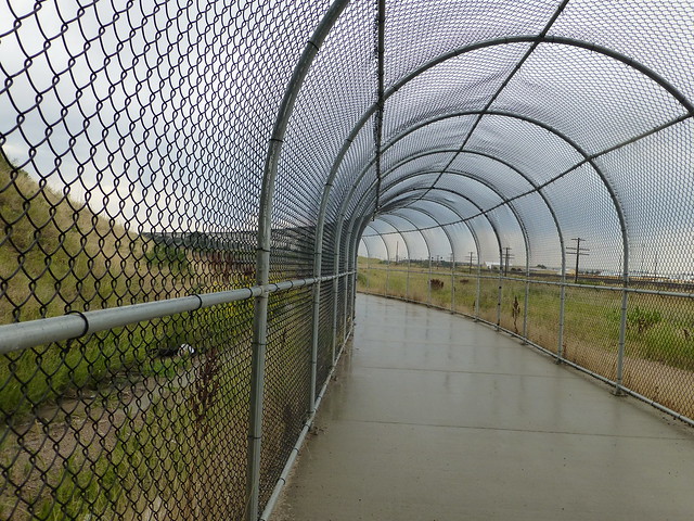
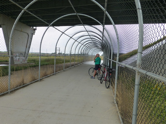
The National Weather Service promised zero percent chance of rain, so we ignored our lying eyes which saw some pretty dark clouds to the west. Of course, our eyes were correct and we had to take shelter under a portico of a rather pretentious apartment house for it to pass.  We then rode to an underpass.  The Union Pacific mainline was to the north, and the city fathers had created a chain link tunnel.  Was it to stop us from running out on the train tracks or throwing things at the trains, or to protect us from things thrown from the overpass?

Tunnel Cheyenne

Mystery Tunnel

Evenutally the rain passed and we were on our way.  A very nice trip.

Mini Tour

IMG_20160812_181703

Saturday early in August.  Not the traditional day or time for the Tour of the Valley, which has been held on the last Sunday in the month.  Not sure why they changed it, and the turnout wasn’t as great as in prior years.   I picked and chose from the 75 mile tour by cutting off the Palisade segment which we rode two days ago.  Met several cycling friends along the way, mostly when they passed me…  The temperature was wonderful and the lunch/party was also enjoyable.  Two brewpubs and a local winery were handing out free samples, and the food was exceptional.  If the barbecue and salad are typical of Community Hospital’s cuisine, I want to go there next time I have to visit a hospital!  The only sour note was when it was time to come home and the rear tire was completely flat.  The guy from the local bike shop had left about a half hour earlier, and I wasn’t in the mood to fix it right there; the good news is that Georgia drove over and brought me home.

[sgpx gpx=”/wp-content/uploads/gpx/AUG-13-16 113210 AM.gpx”]

Palisade

Allen and I rode on part of the 75 mile route for the Tour of the Valley on Saturday:

[sgpx gpx=”/wp-content/uploads/gpx/AUG-11-16 024036 PM.gpx”]

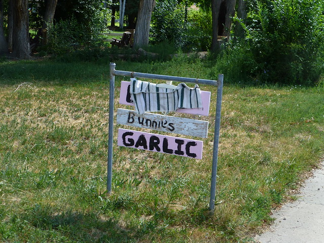
I’ll be taking my much lighter weight/faster Bianchi road bike, but thought it might be fun to take the REI Hybrid.  We didn’t set any speed records – well, actually, I did set one, but it was along Fifth Street in front of the high school.  Before starting up the dreaded 38 Road hill, I saw a couple of interesting sights.  The first was a roadside sign that advertised that they had eggs, bunnies and garlic for sale.  The eggs were apparently sold out, but the bunnies and garlic were still there.  I should have asked the lady if the bunnies were for eating or petting.

Eggs, Bunnies & Garlic

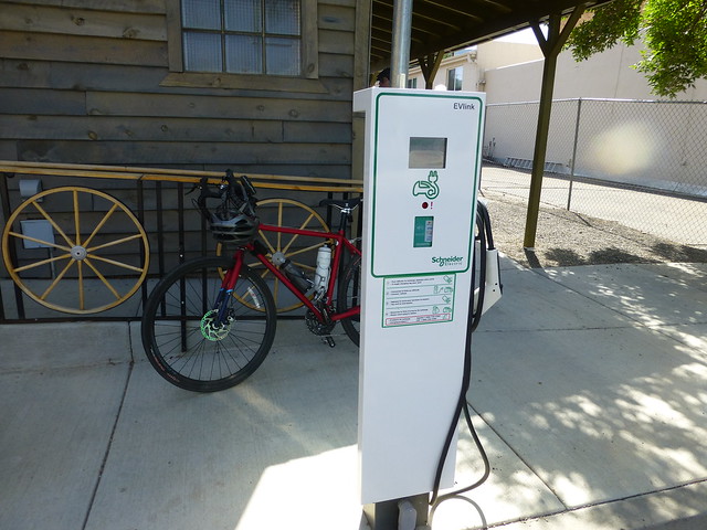
Palisade had a very European looking charging station for electric vehicles.  I don’t know how much a charge would cost, but you can pay with your credit card – if it’s equipped with wireless encoding, which few are.

Electric Vehicle Charging Station

We then proceeded up the 38 Road Hill, commonly known among cyclists as Puke Hill.  It’s a 7-8% grade, and I made a discovery.  My hybrid has such low gears that I can be pedaling like crazy and still going less than 3 miles per hour.  Which isn’t fast enough for me to keep the bike upright.  Which means that I crashed.  No permanent damage to the bike or me, just my ego.

Later, we passed by several orchards and wineries.  We followed a tractor pulling a trailer carrying about eight Hispanic (probably Mexican) farm workers to pick the Palisade peach crop.  They were friendly and waved at us.  Very much unlike some of the impatient Anglos who couldn’t wait to pass our caravan (the Mexicans, me and Allen).

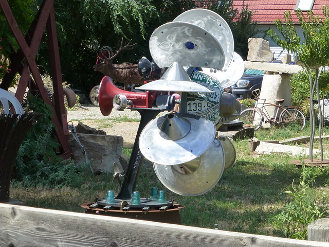
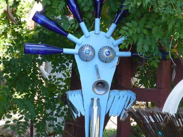
There is one spot where the owner has spent a lot of effort on some very whimsical sculptures.  He has a sense of humor, too.

And some interesting sculptures

In case you were wondering, no, there isn’t a nudist colony one mile ahead.

Whatisit?

More homemade sculptures


« Older posts Newer posts »

Bad Behavior has blocked 1 access attempts in the last 7 days.