Our Notebook

Category: Hobbies (Page 4 of 8)

Elroy – Sparta Trail

[sgpx gpx=”/wp-content/uploads/gpx/SEP-17-16 031826 PM.gpx”]

The Chicago and North Western railroad built a line from Elroy to Sparta, Wisconsin, in the 1870’s.  In order to accommodate the steam engines of the time, the grades were modest, and three tunnels were bored through the hills.

C&NW in 1908

At one time (this is in 1907), three passenger trains per day thundered each direction.

1907 Official Railway Guide

Passenger service ended, and the line was torn up, and in 1967 this became the country’s first rail-trail conversion.

P1030289It’s now recognized as one of the premiere bike paths in the country, and Sparta advertises itself as the Bicycle Capital of America.  The size of the parking lots along the 33 mile route are a good clue that it’s heavily used on summer weekends.

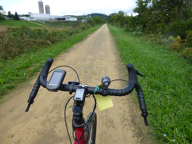
It was a perfect day to explore this trail; the weather was warm but not hot, and puffy white clouds and a canopy of green trees kept the sun away.  The trail itself is not paved; it’s covered with fine gravel which probably could be ridden on a skinny tire road bike, but I was glad to have the 40mm wide tires on my bike.

Leaving Elroy the old railroad grade proceeds up a slight (1-2%) grade through lovely farmland (the Wisconsin license plates used to boast that the state was America’s Dairyland).

P1030297

The yellow tag on my bike is a bike pass; as a state park, you need to pay $5 per day (or $25/year) to use these trails.

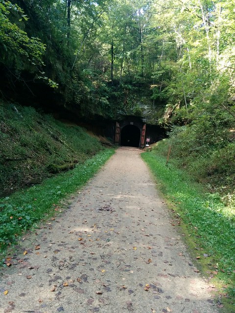
The roadbed continued north and west, and the hills (I refuse to call them mountains) on each side narrowed.  Suddenly: the first of three tunnels.

IMG_20160917_121005

It’s dark and cold inside; you must walk your bike because riders have become disoriented and crashed. It’s not very big, and is hard to imagine  that there was much clearance for a full sized locomotive and railroad car.  The pinhole on the far side got bigger and the opening to the rear got smaller, and about 1600′ later, I emerged into the sunlight.  A nice downgrade, and I arrived at Kendall’s, a little town with a depot, restaurants, and Georgia, who had driven ahead and waited for me.  She discovered an Amish street vendor from whom she bought some nice presents to take home.

P1030290

Tunnel #2 was pretty much the same; on the downhill to the next town and upgrade to #3 I passed an old man who had set up an ice cream cart accessible only to riders.  I imagine he sells out in the summer; and wish I’d stopped.

Tunnel #3 is almost 3/4 of a mile long, and the porous limestone leaks water which gives bikers a cold, refreshing shower through the eastern half.  A school group of middle school boys was walking their bikes the other way, and watching their flashlights bob up and down, and listening to the Halloween noises they were making made the trip very … interesting.


[RFG_gallery id=’18’]

Sakatah Singing Hills State Trail, Mankato, Minnesota


The Sakatah Singing Hills State Trail runs from downtown Mankato to Faribault. Our ride was probably three miles longer than the map above indicates,  because I forgot to turn on the Strava timer until we stopped at an intersection.  Our trip was abbreviated because we left late in the morning, in what looked like a break in storms; one thunderstorm had rolled through and it was overcast but cool and pleasant.  However, the darkening clouds to the west made us decide, very wisely as it turned out, to turn back well before my original goal of Elysian.

As in Iowa, this is a reclaimed railroad grade with a right of way wide enough to permit trees and underbrush to grow up an create the effect of riding in a large, green tunnel.

P1030249

But since this was Minnesota, there were often glimpses of large and small lakes and streams.

I rode with Dan, the host of the AirBNB apartment we rented in Mankato.  He and his wife Sandie exemplify Minnesota nice.  What great people. And Mankato turns out to be a fascinating, vibrant, prosperous city about the size of Grand Junction.  Who knew?  You might think your were transported to Lake Wobegone.

Anyway, the farther away we got from the trailhead, the more ominous the dark and roily clouds to the west appeared.  But Dan timed things with his weather app, and we decided that we should turn back before we had gone too far.  We stopped for a moment at a bike trail-side lounge, but neither of us was in the mood for the walleye lunch special, so we headed back to Mankato, arriving about ten minutes before the heavens opened up and it rained, and rained, and rained.  In the next couple of hours they received almost 2″ of moisture.  It’s been a very wet July and August, and the leaves are just beginning to turn.   Maybe we’ll get a chance to see more in Wisconsin.

More pictures:


[RFG_gallery id=’17’]

High Trestle Trail, Ankeny, Iowa

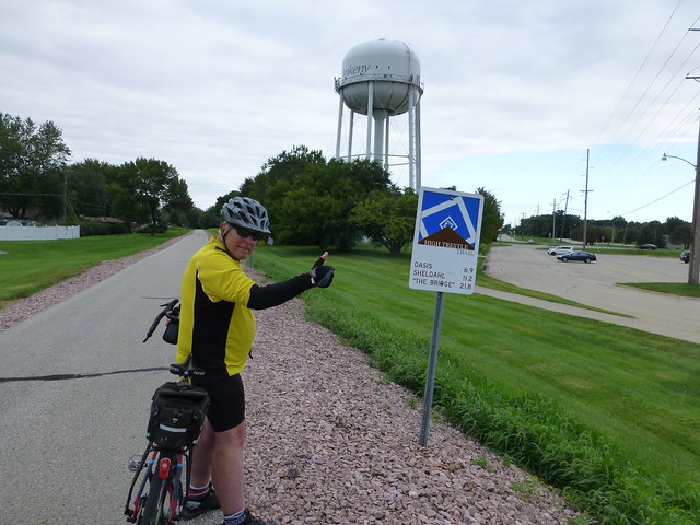
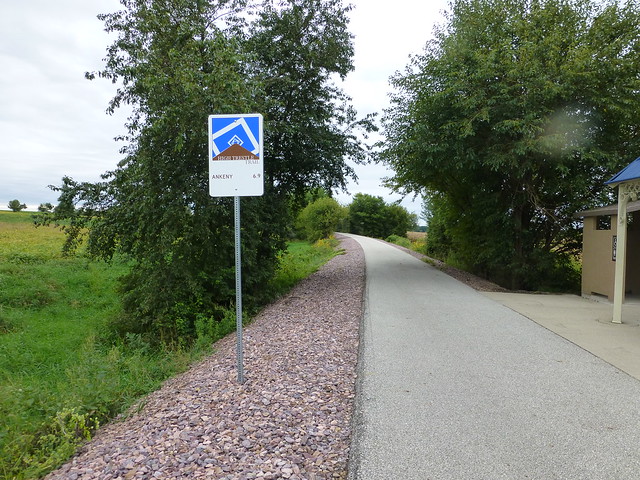
Built in the last few years on the roadbeds of two abandoned railroads, the High Trestle Trail runs from Ankeny, Iowa to Woodward.  No wind, mild overcast day, and flat.  Very flat.  And straight.  The map is deceiving; the incline and descent were almost imperceptible

I joined a friend from Cedar Rapids.  Over twenty years ago we had participated in a bike tour down the Wisconsin river; he took his son, I took Jackie.  we’d kept in touch.  Thanks, Facebook…

P1030200
P1030199
P1030203


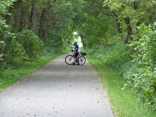
The trail itself is asphalt and concrete, plenty wide and did I say flat?  For several miles, it proceeds northwest from Ankeny through miles of green trees and along rich farmlands.  The forest has reclaimed the area between the plowed fields and the railroad, and creates an effect like riding through a tunnel.  However, the birds and occasional views of sky and little creeks and the birds and squirrels tell you otherwise.

P1030205

There’s even a strategically placed potty stop.  And signs in each of the towns welcome you to fill your water bottle, enjoy their parks…

P1030223

The Milwaukee Road mainline crossed the Des Moines River on a very high trestle   built in 1912.  When the government created Saylorville Lake in 1971, the trestle had to be rebuilt, this time using concrete pillars.  The railroad lasted only another thirty years; when the Union Pacific tore down the bridge, they donated the pillars for the construction of a bike path.  It’s really quite spectacular:

P1030209

Colored LED lights illuminate the metal decorative boxes which enclose the bridge, and at night apparently creates a really spectacular light show.
P1030217

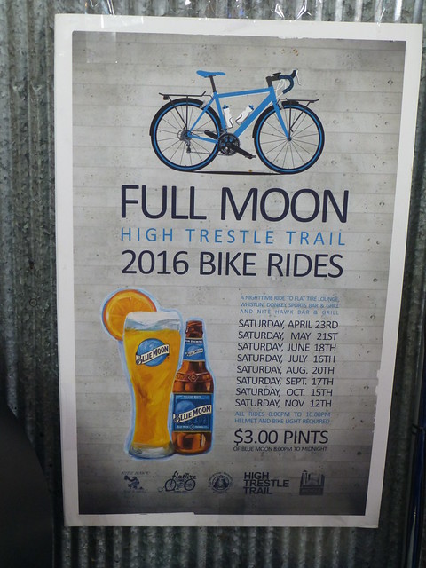
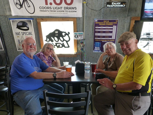
We joined Sharon and Georgia for pizza at the trailside bike-themed Flat Tire Lounge.

P1030233
P1030236

For more pictures, click on the thumbnail:
[RFG_gallery id=’16’]

Wrong turn!

What We Learned Today:  Allen and I learned that the gas plant can’t be reached from 20 Road.

[sgpx gpx=”/wp-content/uploads/gpx/Wrong_turn.gpx”]

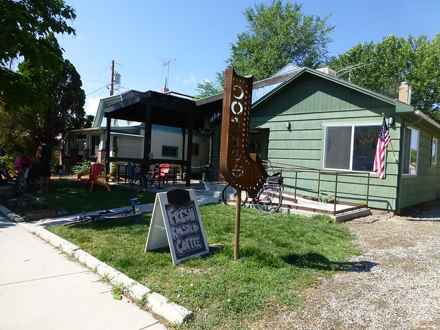
The weather yesterday was delightful – a tailwind to Fruita and calm winds thereafter.  Temperature in the mid 80’s.  Few clouds.  As has become our custom, we stopped at the Bestslope Coffee Company at 129 N. Peach Street.

Fruita Coffee House

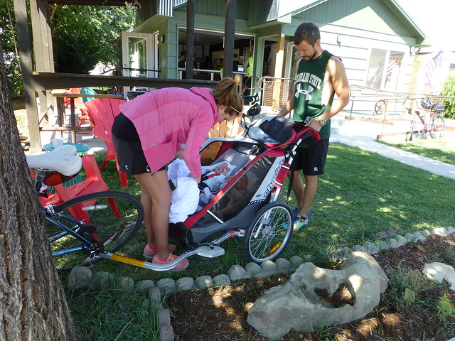
It’s run by a former middle school science teacher and was backed by the Hot Tomato ladies.  The coffee is good, particularly their cold brew, and the company pleasant.  We ran across the parents of 8 week old twin boys, who had taken them out for a ride while Mom & Dad  enjoyed coffee:

Twins

I think the mom is the sister of the owner, and SHE was the one who was hauling the trailer with the little boys.


Fort Laramie

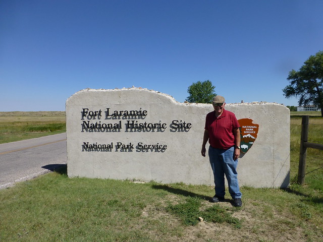
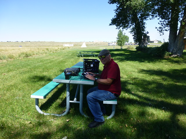
If any ham radio operators read this, are interested in the NPOTA contest and are looking for a great place to activate, I can recommend the Fort Laramie National Historic Site, NS-20.

Ft. Laramie Entrance

It’s located about 2 hours north of Cheyenne, is in a beautiful location, is quite interesting with several restored buildings, has some very helpful rangers and reenactors. And if they aren’t occupied, you can operate out of a tepee. There has been a fort there since 1834, and according to the rangers, every pioneer who traveled west stopped there, so if you set up in the shaded picnic area (or in the tepee) you’re bound to be on the spot where hundreds of covered wagons passed 150 years ago. There aren’t any places to camp on the site, and the nearest motel is about 25 miles away, but it would be worth spending an entire day there. With four trails + a National Historic Site + Wyoming, anyone who sets up there is sure to make lots of contacts, and every one of them will be happy when the log is uploaded.  I only had a brief time yesterday to activate the site, and only got 18 contacts on 20M CW, and wish I could have stayed several hours longer.

Ft. Laramie NHS

The best part is that admission is free!

Cheyenne

Cheyenne has a surprising variety of bike paths, although like Grand Junction, they’re poorly marked.  But if you have a guide, you can see a lot of this interesting city.

[sgpx gpx=”/wp-content/uploads/gpx/AUG-22-16 033355 PM.gpx”]

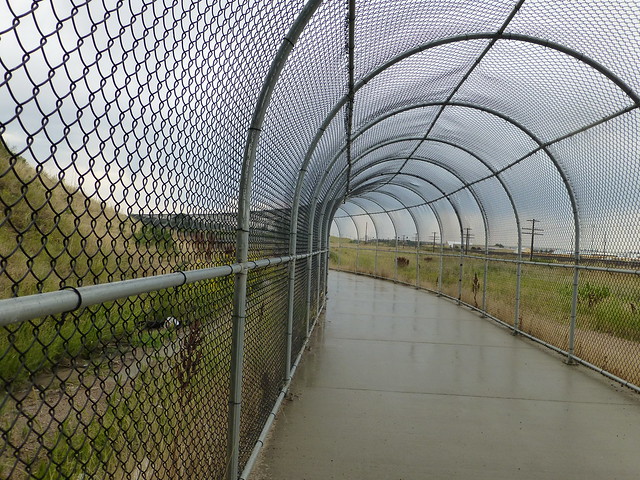
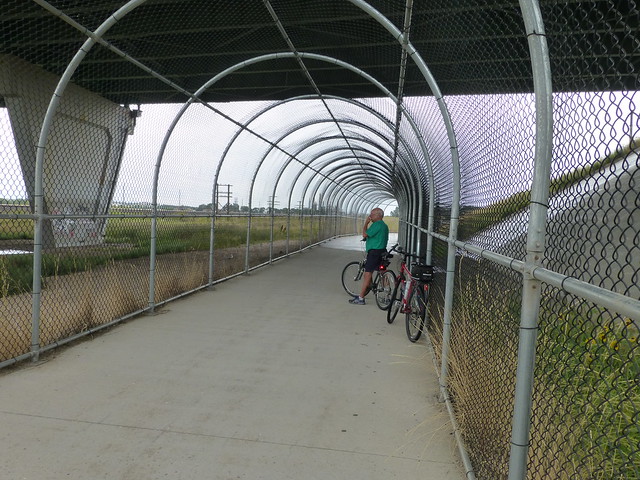
The National Weather Service promised zero percent chance of rain, so we ignored our lying eyes which saw some pretty dark clouds to the west. Of course, our eyes were correct and we had to take shelter under a portico of a rather pretentious apartment house for it to pass.  We then rode to an underpass.  The Union Pacific mainline was to the north, and the city fathers had created a chain link tunnel.  Was it to stop us from running out on the train tracks or throwing things at the trains, or to protect us from things thrown from the overpass?

Tunnel Cheyenne

Mystery Tunnel

Evenutally the rain passed and we were on our way.  A very nice trip.

« Older posts Newer posts »

Bad Behavior has blocked 4 access attempts in the last 7 days.