Our Notebook

Category: Hobbies (Page 3 of 7)

Katy Trail – Preparation and Planning

In June, 2017, we attended the memorial service for  Warren Humble, a good friend from Rifle.  At the service, his wife mentioned how much she and Warren had enjoyed their rail trail bike trips, starting with the Katy Trail in Missouri.  Gene Byrne, another friend from Rifle, and I talked about it later, and as it turns out, both of us wanted to ride the trail…so we talked over the winter and planned it. Our wives, Georgia and Maggie, agreed to accompany us and be our sag wagons.  We decided to meet up in Kansas City and ride at least some of the new Rock Island Spur to the Katy Trail to St. Louis.  Unfortunately, the trail won’t go all the way, but it is close. 

We decided that we were a bit beyond the camping stage, so I found several AirBnBs along the way, and we alternated them with hotels.

As one of the oldest and longest rail-trail conversions, there’s a lot of material available online and by mail on the Katy Trail.  Almost too much information. 

Sources

Books & Pamphlets

  1. The Complete Katy Trail Guidebook by Brett Dufur is invaluable.  It’s also well written and filled with useful information about the trail and your trip.  It cost about $20 and you can buy it through Amazon or directly from the publisher, http://www.pebblepublishing.com.  Make sure you get the most recent edition, which as of 2018 was the 10th.although the website still advertises the 10th Edition
  2. The Missouri State Parks maps of the Katy Trail and the Rock Island Spur.  These are free, and are the best parks maps I’ve ever seen, full of ideas and tips.  They’re available at each of the trailheads,

20180509T143756

and you can request a copy by mail at  https://mostateparks.com/park/katy-trail-state-park or by writing to Katy Trail State Park, 5901 South Highway 163, Columbia, MO 65203.  Phone 573-449-7402.

Online

  1. http://www.bikekatytrail.com/ has a wealth of information and advertisements including facilities available at each of the towns along the way.  The web style is 1995, and some of the information is outdated, but it’s still by far the best resource available online.  There is also an active message board of others who want to take the adventure.
  2. The Rails to Trails conservancy’s website, http://traillink.com, has maps, photos and reviews of the Katy Trail, the Rock Island Spur, and every other worthwhile bike trail in the US.  Consider joining the Conservancy.  It’s a §501(c)(3) charity, so your membership may be tax deductible. 
  3. Google and YouTube list hundreds of personal blogs like this one and videos of adventures along the trail. 
  4. The chambers of commerce and tourist bureaus of the towns along the route have websites of varying usefulness, and listings of hotels and traditional Bed & Breakfasts.
  5. The ubiquitous AirBnb has listings in many, but not all, of the towns along the route.  We were very pleased with the AirBnB in Hermann and Jefferson City.
  6. The Missouri State Parks website includes information on an annual supported trip along the trail.  If you want someone else to plan for you, and you enjoy camping with several hundred of your new friends, this is a good option. If you don’t, several companies offer shuttle and reservations for a semi-supported tour; I have heard good things about Independent Tourist.  The senior-oriented educational group Road Scholar (formerly known as Elder Hostel) also advertises Katy Trail adventures.

Advice

These are my subjective opinions.  Take them for whatever they’re worth.

  1. We went from west to east in 5 days.  It was just the right amount of time for the trip, and I’m glad we went in this direction since the winds and afternoon sun were favorable, and the trail got much more interesting the further east we went.  We went in early May, and the weather was perfect.  Until the last day, no thunderstorms.  We also didn’t see or hear of any tornadoes or flooding.  But it happens. Same, I understand, for the bugs. I wouldn’t want to go in the heat and humidity of July and August, but September and October sure look appealing.
  2. Bring sunscreen and insect repellent. 
  3. The Rock Island Spur is new, interesting and worth taking instead of the Katy Trail from Clinton to Windsor. 
  4. Our overnight stops weren’t chosen well; I didn’t read the fine print in the guidebook.  If we had it to do over again, I would stop at:
    1. Sedalia
    2. Rocheport
    3. Tebbetts
    4. McKittrick/Hermann
    5. St. Charles
  5. If we’d taken Amtrak to Sedalia, and were interested in a less ambitious schedule,  I would have stopped at:
    1. Rocheport
    2. Tebbetts
    3. McKittrick/Hermann
    4. Augusta
    5. St. Charles
  6. There are, shall we say, better overnight choices than McBaine/Columbia and Jefferson City.
  7. The old Sedalia depot, now a museum/gift shop/bike shop is worth an hour, and is a great place to buy souvenirs, jerseys and T shirts, but it closes at 4.  The museum in the Boonville chamber of commerce (located near the Boonville depot) is worth a stop to learn about Lewis & Clark.  You’ll see lots of interpretive signs about their expedition along the trail.

Questions or comments?  Please contact me using this form:

[wpforms id=”1821″]


Biking, 2017

My goal for 2017 was to bike more than 2,000 miles.  I thought it was pretty impressive, but as it turns out, many of my biking friends in the area consider 5,000 miles to be a more ambitious goal.  But then I’ve been biking seriously again only since my motorcycle crash.

Here’s my 2017 results:


I achieved my goal in late October, about a mile from our house. 

IMG_20171023_134516

Later, my friend Allen and I rode the “Tour of the Moon”  over the Colorado National Monument.  I was wearing a jersey from a friend I discovered on Strava; he and his wife retired and live  in the French mountains; he was an architect and she was an educator.  He rides about as often as I do, although he’s faster.

[RFG_gallery id=’19’]

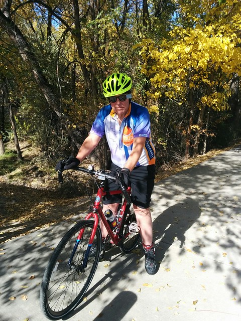
Here are some random scenes as I racked up the miles:

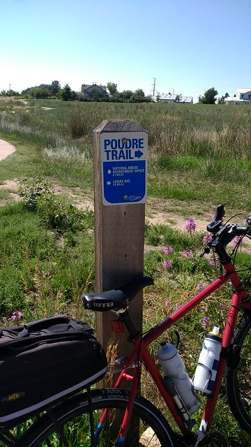
With Michael Starks along the Poudre Trail in Fort Collins

IMG_20170819_104355123IMG_20170819_111942334
With Allen along the Rio Grande Trail from Glenwood Springs to AspenIMG_20170727_144755152
  Our favorite coffee stop, Bestslope Coffee in Fruita, Colorado
IMG_20170526_115657019
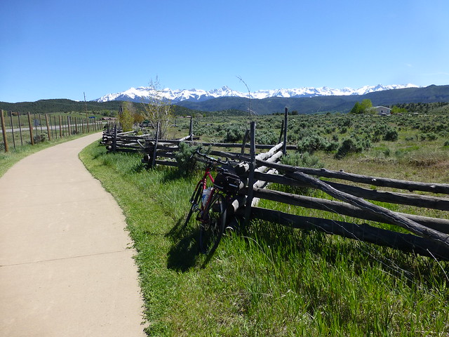
Ridgway, Colorado
Ridgway, Colorado
Other photos along the route:
IMG_20170502_113811422IMG_20170422_122018275
Reeder Mesa
IMG_20170419_130335233

Illinois Prairie Path Sampler


The Illinois Prairie Path trail is probably the second rail-trail in the country, and was created on the right of way of the abandoned Chicago, Aurora and Elgin electric railroad.  The CA&E has a long history; it was built in 1902 and the railroad was abandoned in 1958. In 1963, the entire length was converted to a bike/pedestrian trail running from Chicago to the Fox River cities of Aurora and Elgin.

The CA&E ran from the Chicago loop, and my mother often took us to downtown Chicago on the train, not the car.  Riding the big third rail electric cars from Elmhurst to the city along the private right of way and on the L (elevated) tracks made a lasting impression on me.

In an unparalleled display of municipal short-sightedness, the railroad went bankrupt in 1957, and no government entity took it over.  A judge signed an order authorizing abandonment just before lunch, and all of the trains were recalled to Wheaton by noon, leaving many stranded – and angry and frustrated – commuters with no way to get home.  It made the front page of the Chicago papers.  I remember it.

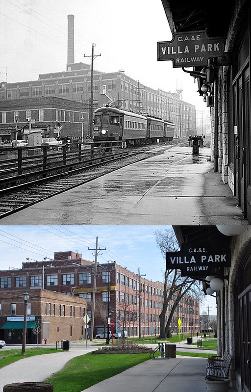
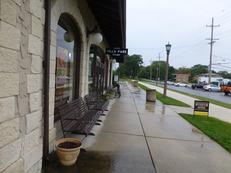
The abandoned right of way was converted to a trail in 1963, so it’s actually been a trail almost as long as it was a railroad.  We had hoped to ride from Wheaton east at least to beyond Elmhurst, and perhaps beyond, but the 80% chance of precipitation proved too accurate.  Being obsessed with this ride, I forced my cousin Mike to ride in the rain a few miles from the Villa Park station to York Road, where we’d caught the train years ago. The station is located near the old Ovaltine factory:

CA&E Villa Park Station

(Thanks to Glen Brewer, whose web page has a lot more on the CA&E http://RailroadGloryDays.com/cae.)

The gray and gloomy day when we got there:
P1030331

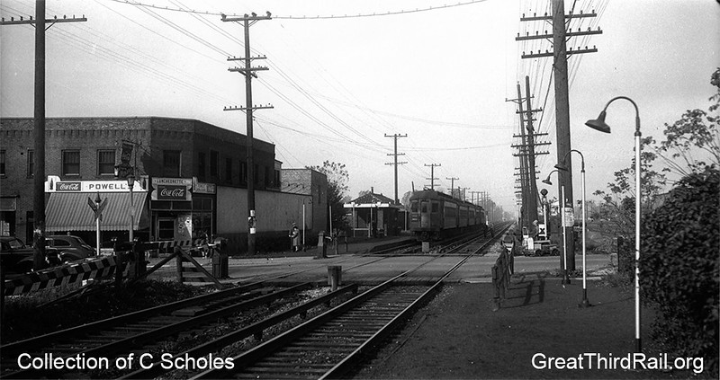
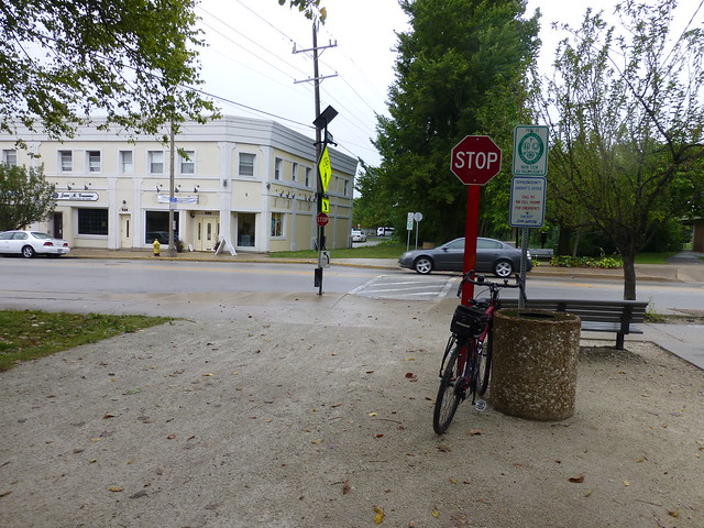
Only a few miles east we crossed York Road.  I recall that my dentist’s office was on the second floor of the building on the corner, above a drug store, and I could watch the trains roll by while getting my cavities filled.

york1a

It’s now an art gallery

P1030328

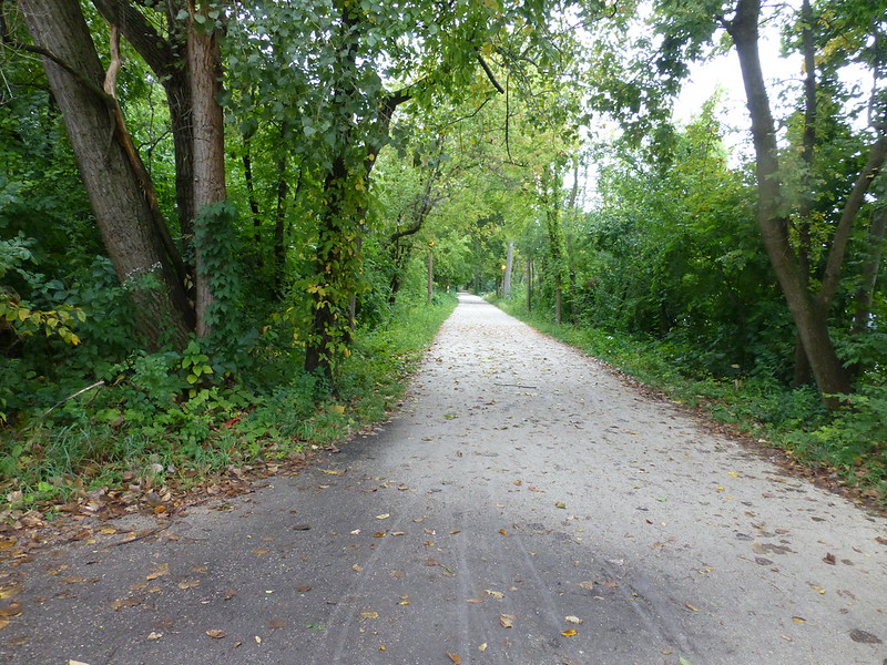
It’s ironic that the adjoining property owners bitterly resisted the conversion of the right of way to a trail (they wanted the property to enlarge their back yards); the path has apparently substantially improved their property values, and the tiny WWII crackerbox houses along the way have been converted to Illinois McMansions.

P1030330

So the Prairie Path remains on my list of must-ride trails. It is even possible to ride from Elmhurst to my cousin Bob’s house in Plainfield in less than 4 hours, almost entirely on bike trails. Next time ….

Elroy – Sparta Trail

[sgpx gpx=”/wp-content/uploads/gpx/SEP-17-16 031826 PM.gpx”]

The Chicago and North Western railroad built a line from Elroy to Sparta, Wisconsin, in the 1870’s.  In order to accommodate the steam engines of the time, the grades were modest, and three tunnels were bored through the hills.

C&NW in 1908

At one time (this is in 1907), three passenger trains per day thundered each direction.

1907 Official Railway Guide

Passenger service ended, and the line was torn up, and in 1967 this became the country’s first rail-trail conversion.

P1030289It’s now recognized as one of the premiere bike paths in the country, and Sparta advertises itself as the Bicycle Capital of America.  The size of the parking lots along the 33 mile route are a good clue that it’s heavily used on summer weekends.

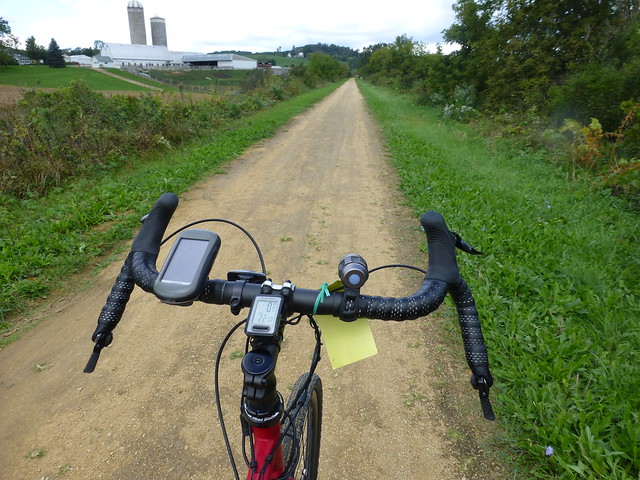
It was a perfect day to explore this trail; the weather was warm but not hot, and puffy white clouds and a canopy of green trees kept the sun away.  The trail itself is not paved; it’s covered with fine gravel which probably could be ridden on a skinny tire road bike, but I was glad to have the 40mm wide tires on my bike.

Leaving Elroy the old railroad grade proceeds up a slight (1-2%) grade through lovely farmland (the Wisconsin license plates used to boast that the state was America’s Dairyland).

P1030297

The yellow tag on my bike is a bike pass; as a state park, you need to pay $5 per day (or $25/year) to use these trails.

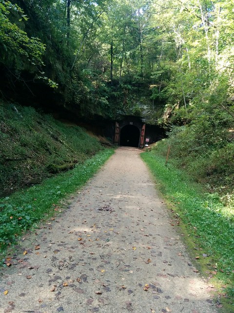
The roadbed continued north and west, and the hills (I refuse to call them mountains) on each side narrowed.  Suddenly: the first of three tunnels.

IMG_20160917_121005

It’s dark and cold inside; you must walk your bike because riders have become disoriented and crashed. It’s not very big, and is hard to imagine  that there was much clearance for a full sized locomotive and railroad car.  The pinhole on the far side got bigger and the opening to the rear got smaller, and about 1600′ later, I emerged into the sunlight.  A nice downgrade, and I arrived at Kendall’s, a little town with a depot, restaurants, and Georgia, who had driven ahead and waited for me.  She discovered an Amish street vendor from whom she bought some nice presents to take home.

P1030290

Tunnel #2 was pretty much the same; on the downhill to the next town and upgrade to #3 I passed an old man who had set up an ice cream cart accessible only to riders.  I imagine he sells out in the summer; and wish I’d stopped.

Tunnel #3 is almost 3/4 of a mile long, and the porous limestone leaks water which gives bikers a cold, refreshing shower through the eastern half.  A school group of middle school boys was walking their bikes the other way, and watching their flashlights bob up and down, and listening to the Halloween noises they were making made the trip very … interesting.


[RFG_gallery id=’18’]

« Older posts Newer posts »

Bad Behavior has blocked 4 access attempts in the last 7 days.